-
01Risk Monitoring Based on Field Video
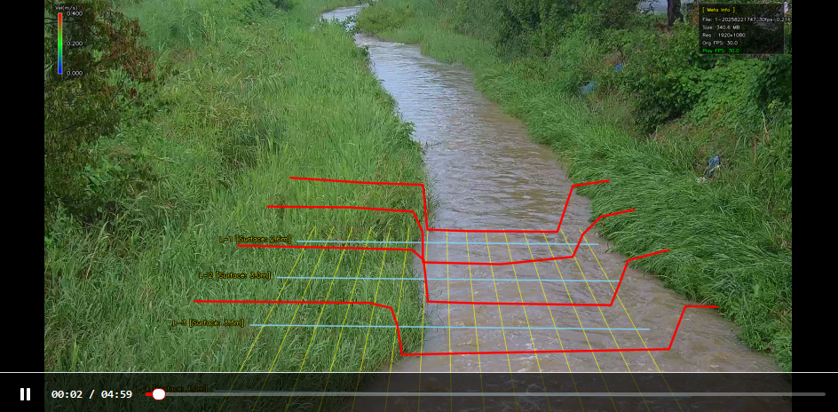
Field CCTV video is used to monitor river and waterway conditions at all times, while surface flow and surrounding changes are used as key data for flood risk assessment.
-
02Integrated Analysis of River Width, Level, and Velocity
River width information, ultrasonic level meter data, and image velocimeter data are combined to analyze changes in water level, velocity, and flow for more precise risk assessment than simple level monitoring.
-
03Vision AI Analysis and Warning Decision
The system combines video analytics and instrumentation data to evaluate water level rise against river width, velocity increase, and flow changes, enabling proactive assessment of inundation and overflow risks.
-
04Control System Integration
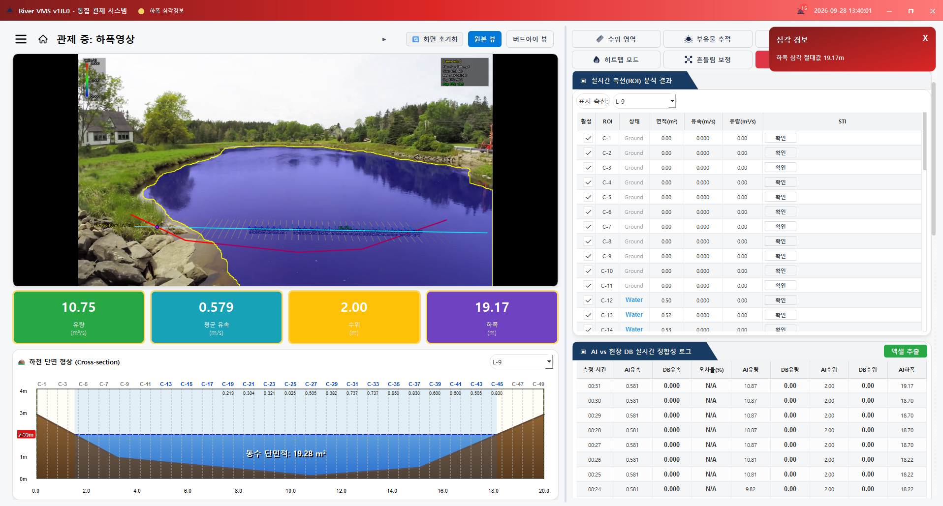
By linking the field control panel, data collection server, and monitoring screen, operators can view real-time video, measurement values, and historical data on one screen for rapid response.
Principle of Image-based Velocity Analysis
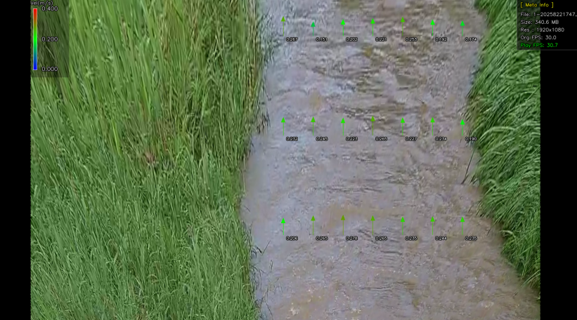
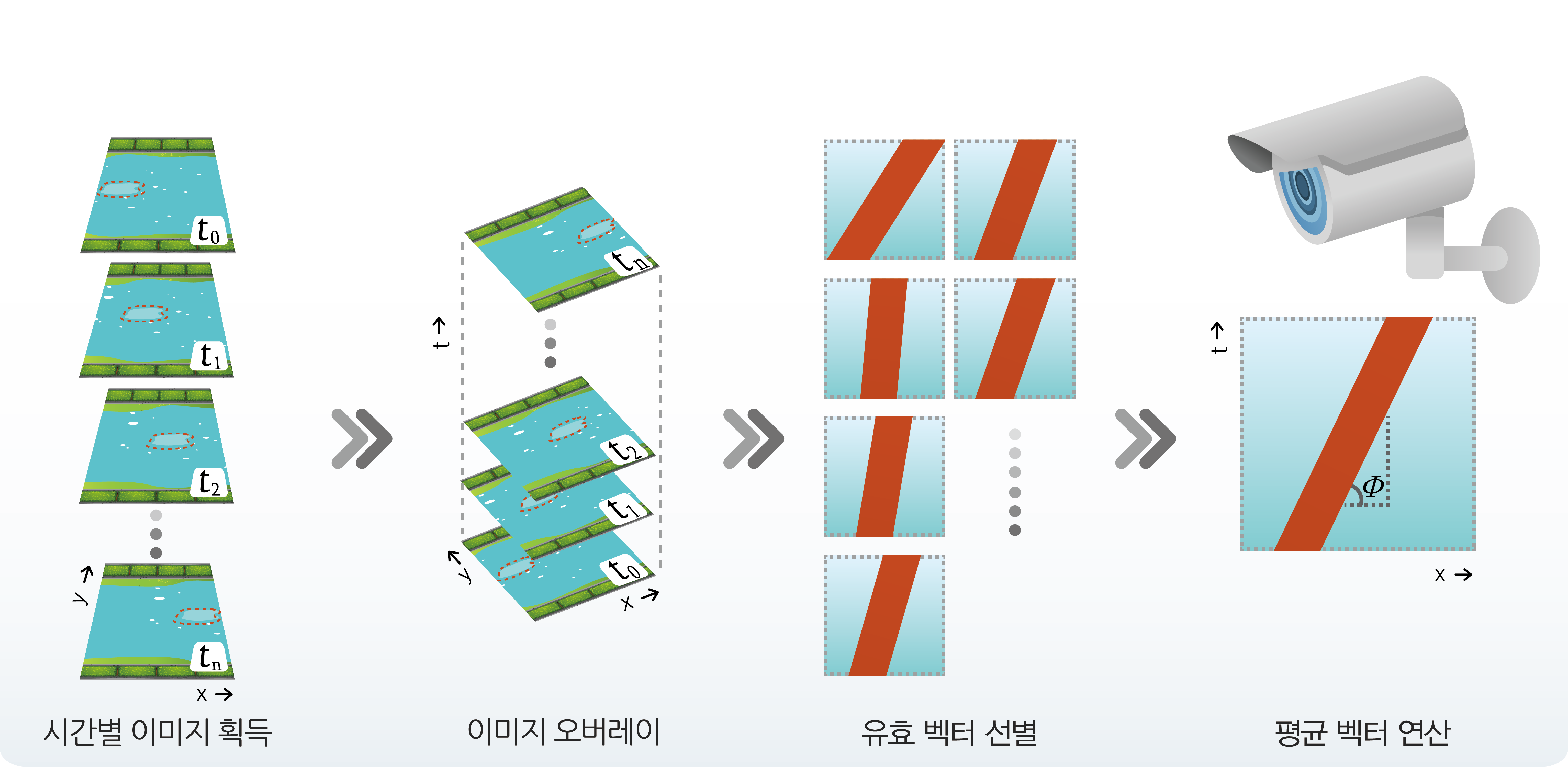
Sequential river images are aligned over time, and the movement direction and speed of surface feature points are extracted as vectors. Valid vectors are selected and averaged to calculate image-based velocity data, which is then combined with river width and water level data to assess flow changes and flood risk.
Flood Forecasting Data Flow
River video and field measurement data are collected and analyzed on the server. Operators can view water level changes based on river width, flow and velocity history, and real-time video together on the monitoring screen. This enables site verification, data analysis, risk assessment, and warning delivery in one operating workflow.

Actual Operation Screens
Operators can quickly identify river condition changes and risk signs by viewing field video, water level by river width, velocity and flow values, and historical data on the monitoring screen.